A College in the Heart of
New Jersey
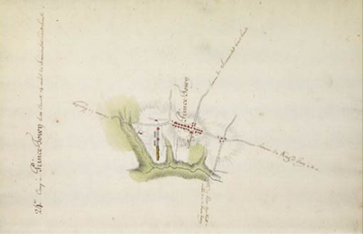
The 1781 topographic map, showing the encampment of the Continental Army, clearly depicts Nassau Street on high, protected ground. Set on a topographic ridge, on an area of 4.5 acres, Nassau Hall was the largest academic building in the colonies at the time and had an expansive rural panorama of farmland and a forested stream valley to the south.
Images: Graphic Arts Collection and University Archives, Department of Rare Books and Special Collections, Princeton University Library. Courtesy of The Historical Society of Princeton.
Photos: Courtesy of the Princeton University Office of Communications.
© 2006 The Trustees of Princeton University Last update: November 2, 2006